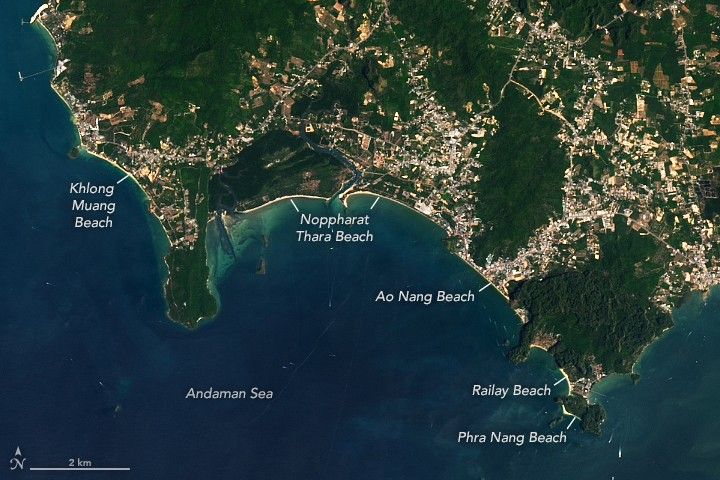
From an altitude of several hundred miles, the western coast of Southern Thailand appears as a high-contrast study in geologic history and human settlement. New imagery captured by the Operational Land Imager (OLI) on Landsat 8 reveals the Krabi Province not merely as a tropical destination, but as a complex intersection of limestone karst towers, mangrove forests, and expanding built-up areas. The tan ribbons of sand that define the Andaman Sea coastline serve as the literal interface between the deep-time chemistry of the earth and the modern economy.
The region’s defining features—the towering limestone formations that draw rock climbers to Railay and Phra Nang beaches—are the result of a precise environmental recipe. These karsts are composed of calcium carbonate, the lithified remains of ancient marine organisms. Over millions of years, the accumulation of skeletal debris and the specific pressures of the tropical climate have sculpted a landscape that is as much a biological record as it is a geological one.
While the satellite data highlights the natural grandeur of Ao Phangnga bay, it also documents the footprint of the present. The bright expanses of beach and the clusters of human development sit in the shadow of these massive limestone walls, illustrating the tension between preservation and the global tourism industry. From this perspective, the Krabi coast is seen as a fragile, evolving system where ancient marine history meets the rapid pace of 21st-century geography.
With reporting from NASA Breaking News.
Source · NASA Breaking News