Agricultural automation has long been hindered by a paradox: the machines designed to save labor often require an immense amount of it to set up. Most current spraying drones are general-purpose models retrofitted for the field, requiring human operators to meticulously map every acre and rebuild flight plans whenever the canopy shifts or terrain changes. For the massive industrial estates of Southeast Asia — where a single palm oil concession can span tens of thousands of hectares — these preparation stages create a bottleneck that limits the scale of drone deployment.
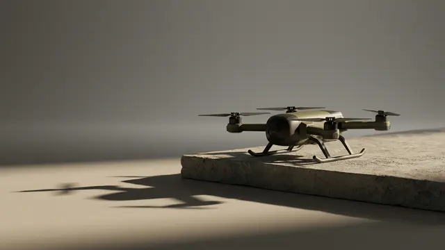
A new joint venture between Singapore-based DroneDash Technologies and GEODNET, dubbed GEODASH Aerosystems, seeks to eliminate this friction. Their near-production drone technology shifts the burden of navigation from the operator to the aircraft's onboard intelligence. By combining AI-driven computer vision with high-precision positioning correction, the drones can perceive rows, trees, and terrain in real-time, achieving a navigational accuracy of one centimeter without a pre-existing map.
From pre-mapped routes to real-time perception
The conventional workflow for agricultural drone spraying follows a rigid sequence: survey the field, generate a georeferenced map, build a flight plan, execute the mission, and repeat whenever conditions change. Each step demands skilled labor and specialized software. On crops with relatively stable geometry — flat rice paddies, for instance — the overhead is manageable. On tree plantations, where canopy height varies, terrain undulates, and new growth can alter the landscape within weeks, the map degrades almost as fast as it is produced.
What GEODASH Aerosystems describes is a shift from route-following to real-time perception-and-action. Rather than relying on a static digital twin of the field, the drone interprets its surroundings through onboard computer vision and adjusts its behavior accordingly — modifying altitude, spray rate, and trajectory as it flies. The underlying positioning layer draws on GEODNET's decentralized network of real-time kinematic (RTK) base stations, a technology that corrects satellite positioning signals to achieve centimeter-level accuracy. RTK correction has been used in precision agriculture for years, primarily in ground-based equipment; applying it to autonomous aerial platforms operating without pre-mapped routes represents a meaningful integration challenge.
The approach echoes a broader pattern in robotics: the migration from scripted automation, where every movement is pre-programmed, to adaptive autonomy, where the machine responds to its environment in real time. Warehouse robots made this transition over the past decade. Agricultural drones, operating in far less controlled environments, have been slower to follow.
Strategic context: Southeast Asia's plantation economy
The choice of Southeast Asian palm oil plantations as a primary use case is deliberate. The region accounts for a dominant share of global palm oil output, and the industry faces persistent labor shortages compounded by regulatory pressure to reduce chemical runoff. Precision spraying — applying inputs only where needed, at the correct dosage — addresses both problems simultaneously, but only if it can be deployed at scale without proportional increases in skilled operators.
The competitive landscape for agricultural drones in the region has been shaped largely by Chinese manufacturers, whose platforms dominate the market for general-purpose spraying. GEODASH Aerosystems appears to be positioning itself not as a hardware competitor but as a systems integrator, differentiating on autonomy rather than airframe cost. Whether that distinction holds commercial weight will depend on whether plantation operators value reduced setup time enough to adopt a less established platform.
There is also a regulatory dimension worth watching. Aviation authorities across Southeast Asia have been tightening rules around beyond-visual-line-of-sight (BVLOS) drone operations — precisely the category that fully autonomous agricultural flights would fall into. A drone that can demonstrate centimeter-level situational awareness may find an easier path through regulatory approval than one relying on pre-programmed waypoints, but the certification frameworks are still evolving.
The tension at the center of this development is familiar in agricultural technology: the gap between what is technically feasible in a demonstration and what is operationally viable across millions of hectares, maintained by workers with varying levels of technical training, in conditions that change with every rainy season. GEODASH Aerosystems has articulated a clear engineering thesis — replace the map with perception. The open question is whether the economics and regulatory environment of industrial plantation agriculture will reward that thesis at the scale it requires to matter.
With reporting from AI News.
Source · AI News