The study of volcanic activity has long relied on the assumption that extended periods of silence—often spanning hundreds of thousands of years—serve as a reliable indicator of a volcano’s terminal state. According to recent reporting from Dagens Nyheter, researchers investigating a dormant volcano in Greece have identified significant accumulations of liquid magma beneath the surface, despite the site having remained inactive for over 100,000 years. This discovery challenges the conventional binary classification of volcanoes as either active or extinct, suggesting that the interior of these structures may remain dynamic far longer than previously theorized.
This finding carries substantial implications for how global geological risk is assessed and communicated to the public. If dormant structures can harbor active reservoirs, the traditional reliance on historical eruption frequency as a primary metric for safety may be fundamentally flawed. The research underscores the necessity of moving beyond surface-level observations toward a more comprehensive, high-resolution mapping of the crustal and sub-crustal processes that dictate long-term volcanic behavior.
The Limitations of Historical Chronology
Historically, volcanology has been dominated by a deterministic approach that interprets the absence of recent activity as a sign of geological stability. In many regions, the criteria for designating a volcano as "extinct" or "dormant" are often tied to arbitrary timelines, such as the Holocene epoch or specific intervals of inactivity. However, these human-centric timeframes rarely align with the geological timescales governing plate tectonics and mantle plumes. The Greek case serves as a stark reminder that the Earth’s crust is not necessarily static simply because it fails to produce visible eruptive events on a human schedule.
Structural context is essential here. The accumulation of magma is a slow, iterative process involving the migration of melt through the lithosphere, often occurring in deep-seated reservoirs that do not immediately manifest as surface deformation. By focusing exclusively on volcanoes with recent historical activity, regulators and disaster management agencies may be inadvertently overlooking sites that are undergoing subtle, long-term recharge. This creates a blind spot in hazard mapping, where the perceived safety of a region is based on a lack of data rather than a lack of underlying geological energy.
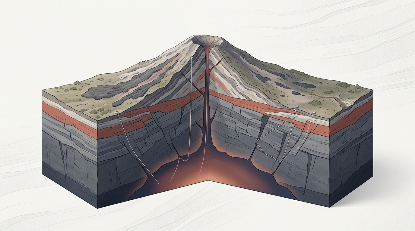
Mechanisms of Subsurface Recharge
Understanding how a volcano maintains a "living" state after millennia of silence requires a deeper look at the fluid dynamics of magma chambers. Magma is not a static pool; it is a complex, evolving system influenced by thermal gradients, pressure changes, and the continuous injection of juvenile melt from the mantle. When a volcanic system enters a period of dormancy, the cooling rate of the remaining magma and the rate of new flux determine whether the system effectively dies or enters a state of latent potential. The research in Greece indicates that these systems can sustain a state of semi-permeable equilibrium, where the architecture of the crust allows for the persistence of liquid fractions over geological eons.
This mechanism suggests that volcanic systems are far more resilient and persistent than previously modeled. The presence of liquid magma at depth acts as a heat source that can influence local seismic activity and hydrothermal systems, even without a catastrophic eruption. By utilizing advanced geophysical imaging—such as seismic tomography and magnetotellurics—scientists are beginning to visualize these deep reservoirs with unprecedented clarity. The challenge lies in interpreting these signals, as the presence of magma does not automatically guarantee an imminent eruption; rather, it indicates that the system possesses the necessary fuel to potentially transition into an active phase if trigger conditions, such as tectonic shifts or pressure buildup, are met.
Implications for Risk and Policy
For regulators and policymakers, the implications of these findings are profound. Current land-use planning, critical infrastructure siting, and emergency preparedness protocols are often built upon maps that categorize zones based on the probability of future eruptions. If the definition of a "hazardous" volcano must now expand to include systems that have been quiet for over 100,000 years, the scope of high-risk zones could broaden significantly. This creates a tension between the need for scientific accuracy and the economic realities of urban development in regions with complex volcanic histories.
Furthermore, the scientific community faces a communication challenge. Conveying the nuance that "active magma" does not equate to "imminent danger" is difficult in a public discourse that often demands binary answers. Regulators must now navigate the complexity of managing long-term, low-probability risks while maintaining public trust. If we acknowledge that dormant volcanoes are more dynamic than we previously thought, we must also invest in the monitoring infrastructure required to track these deep-seated changes, shifting from a reactive posture to one of continuous, long-term observation.
Open Questions in Geophysical Modeling
Despite the technological advancements in monitoring, several uncertainties remain. We still lack a clear understanding of the specific triggers that cause a long-dormant system to transition into an eruptive state. Is it a gradual increase in volume, or does it require a sudden, external tectonic event to rupture the crustal seal? Furthermore, the variability between volcanic systems means that a model developed for one region may not apply elsewhere, complicating the creation of a universal standard for risk assessment.
Looking ahead, the focus must shift toward integrating deep-crustal imaging with historical records to build more robust predictive models. We must ask whether our current observation networks are sensitive enough to detect the subtle, long-term recharge cycles that characterize these "stendöd" (seemingly dead) volcanoes. As research continues to refine our view of the subterranean world, the static maps of the past will likely give way to dynamic, probabilistic models that account for the hidden vitality beneath our feet.
As the scientific community continues to map the deep-seated reservoirs that defy traditional timelines of volcanic activity, the distinction between dormant and active systems will likely become increasingly fluid. The challenge for the coming decade will be to reconcile these findings with the practical requirements of geological risk management, ensuring that policy keeps pace with our deepening understanding of the Earth’s inner workings.
With reporting from Dagens Nyheter
Source · Dagens Nyheter


